Suggested citation format:
Ciolek, T. Matthew (ed.). 1999 - present. Georeferenced historical transport/travel/communication routes and nodes - Old World. OWTRAD Dromographic Digital Data Archives (ODDDA): Old World Trade Routes (OWTRAD) Project. Canberra: www.ciolek.com - Asia Pacific Research Online.
www.ciolek.com/OWTRAD/DATA/oddda.html

OWTRAD Dromographic Digital Data Archives
(ODDDA)
Georeferenced historical transport/travel/communication
routes and nodes - Old World

edited by

Dr T. Matthew Ciolek,

Research School of Pacific and Asian Studies,
Australian National University, Canberra ACT 0200, Australia
tmciolek@ciolek.com
http://www.ciolek.com/PEOPLE/ciolek-tm.html

Document created: 7 Jul 1999. Last updated: 29 Jan 2007

This document catalogs and archives data sets about historical transport/travel/communication routes and nodes. These geo- and chrono-referenced data have been constructed as a part of the Old World Trade Routes (OWTRAD) project.

NOTE: Researchers wishing to publish at this address their own data sets
dealing with communication and transport networks world-wide are warmly invited to contact the site's editor.

Five most recently added data sets are:
* Moldavia and Transylvania, 1450-1500 CE, trade routes * Iran and Turkmenistan, 900-1300 CE, Caravan routes * China, 1368-1644 CE, Imperial courier (I-chan) routes * East Africa, 1700-1890 CE, 'The Central Slave and Ivory' trade route * Old World, 500 BCE-2000 CE, significant nodes: Caravan halting places

Five most recently updated data sets are:
* tmc-nodes-RHSE.html * tmcTRm1300.html * tmcCNm1950.html


|| OWTRAD Home Page || Notation System || Gazetteer || Catalogue of Caravanserais/Khans || Trade Routes' Glossary || Sources and Bibliography || ODDDA Home Page ||

Dromography (Gr. 'dromos' [way, street, route, corridor] + Gr.'graphos' [to write]) - the study of geography, history and logistics of transportation, movement, and communication routes [The term 'dromography' was coined by T. M. Ciolek, in April 2001]

Cumulative visual index of 64 dromographic digital data sets (Series 1: Routes)
georeferenced and published at this site since July 1999.

trade routes of Africa and Europe
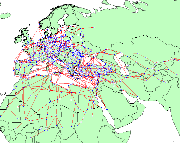
|| Africa data sets || Europe data sets || Timeline of the data sets ||

trade routes of Asia
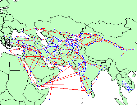
|| Asia & ME data sets (without China data sets), in: Asia & the Middle East data sets || Timeline of the data sets ||
trade routes of Asia
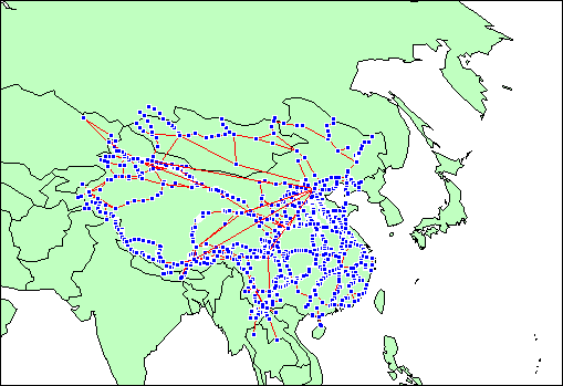
|| China data sets (without other Asia & ME data sets), in : Asia & the Middle East data sets || Timeline of the data sets ||

Cumulative visual index of 2 dromographic digital data sets (Series 2: Significant Nodes)
georeferenced and published at this site since Oct 2006.

Caravan halting places Eurasia and Northern Africa
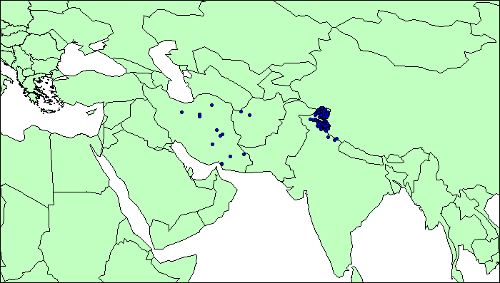
HALT: Caravan halting places
See also other Old World nodes
  Funduks, hospices/inns, and caravanserais in Eurasia and Northern Africa
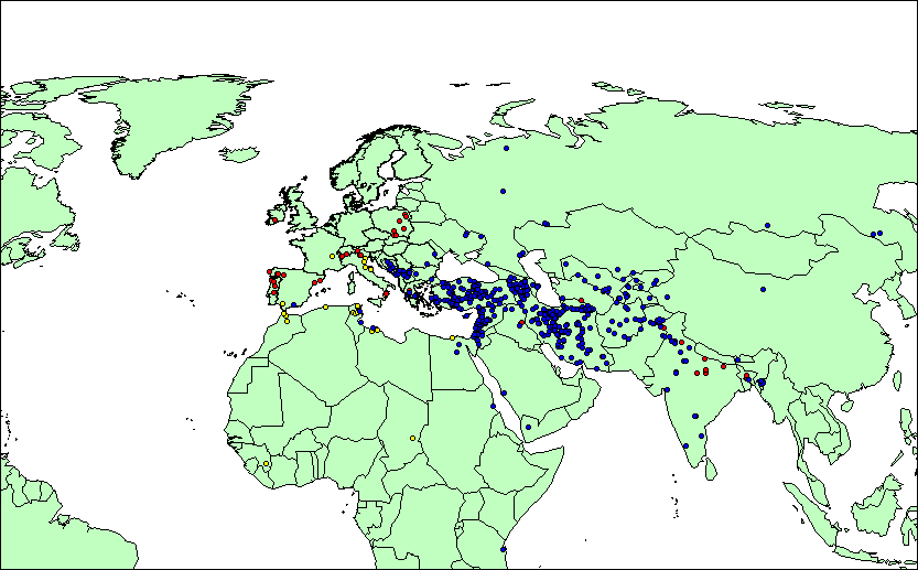
RHSE: Funduks, hospices/inns, and caravanserais
See also other Old World nodes

Google [Search by authors, route, cargo, geography, or time-period]
 
Web ODDDA georeferenced data sets

Maintainer: Dr T. Matthew Ciolek (tmciolek@ciolek.com)

Copyright (c) 1999 - present by T. Matthew Ciolek. Creative Commons License OWTRAD materials and data sets may be distributed only subject to the terms and conditions set forth in the Creative Commons Attribution-Noncommercial 2.5 License. Please direct comments, questions or requests about this license policy to tmciolek@ciolek.com.


Site Meter
visitors to www.ciolek.com since 08 May 1997.

Return to OWTRAD home page.
URL http://www.ciolek.com/OWTRAD/DATA/oddda.html

[www.ciolek.com]