 for updates/corrections and new datasets for updates/corrections and new datasets
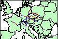
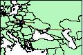
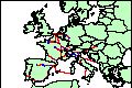
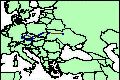 tmcCZm0800.html Central Europe, 800-900 CE, trade routes
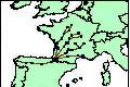
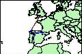 tmcESm1400.html Spain, 900-2000 CE, pilgrimage routes
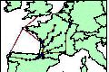
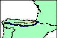 tmcESm1999.html Spain, 1999 CE, pilgrimage routes
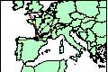 tmcFRm1300.html France, 900-2000 CE, pilgrimage routes
 tmcFRm1500.html France, 1000-1500 CE, pilgrimage routes
 tmcFRm1500a.html France, 1000-1500 CE, pilgrimage routes - dataset 2
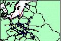
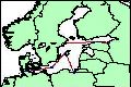
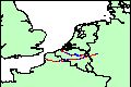 tmcBEm1100.html North-Western Europe, 1100-1500 CE, woollen cloth trade routes
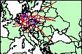
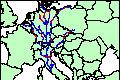 tmcDEm1500.html Central Europe, 1500 CE, pilgrimage routes to Rome
 tmcDEm1500a.html Southern Germany, 1450-1500 CE, trade routes
 tmcMDm1470.html Moldavia and Transylvania, 1450-1500 CE, trade routes [NEWEST DATASET, published Jan 2007]
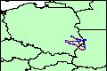
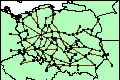 tmcPLm1150.html Poland, 1130-1180 CE, major roads
 tmcPLm1370.html Poland, 1370 CE, major roads
 tmcPLm1370a.html Poland, 1340-1400 CE, major trade roads
 tmcPLm1370b.html Poland, 1200-1450 CE, major trade roads
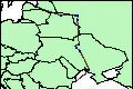
 tmcPLm1400.html Poland and Ukraine, 1200-1700 CE, trade routes
 tmcUAm1000.html Ukraine, 992-1025 CE, trade routes
 tmcXBLm0800.html Baltic Sea, 800-900 CE, trade routes
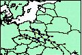
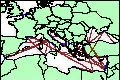 tmcXMEm0200.html Mediterranean Sea, 130 BCE - 200 CE, trade routes
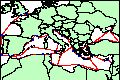 tmcXMEm1400.html The Black Sea, Mediterranean and the Atlantic coast of Western Europe, 1400-1530 CE, Venetian galley-operated trade routes
 tmcZCEm0100.html Central Europe, 200 BCE - 400 CE, 'Amber Road' trade routes
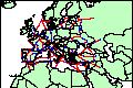 tmcZWEm1300a.html Europe, Levant and North Africa, 1300-1500 CE, trade routes
 tmcZWEm1400a.html Western Europe, 1370-1430 CE, banking courier routes
 tmcZCEm1500.html Central Europe, 1500 CE, 'Holy Roman Empire' trade routes
Copyright (c) 1999 - present by T. Matthew
Ciolek.
 OWTRAD materials and data sets may be distributed only subject to
the terms and conditions set forth in the Creative Commons Attribution-Noncommercial 2.5 License.
Please direct comments, questions or
requests about this license policy to tmciolek@ciolek.com.
OWTRAD materials and data sets may be distributed only subject to
the terms and conditions set forth in the Creative Commons Attribution-Noncommercial 2.5 License.
Please direct comments, questions or
requests about this license policy to tmciolek@ciolek.com.